Boynton’s Agricultural History

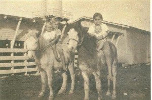
Weaver Family

Weaver Family

Boynton Beach has a rich agricultural history, and the fertile land is what first brought settlers to the area. The original farmed areas were situated along the newly dug coastal canal, where farmers raised tomatoes, beans, celery and other winter vegetables. Boynton was most famous for its bumper tomato crop. Further inland west of the Dixie Highway, farmers planted pineapples on the coastal ridge, where the ‘pines’ thrived in the sandy soil.
Dairy farming became a vital industry. The area that is today Briny Breezes saw the first dairy, owned by Ward Miller. The close proximity to the salt air meant fewer bothersome insects to annoy the cows. As ocean front land increased in value, the dairies relocated further west along the Military Trail and what would become Congress Avenue. Dairymen such as the Melears, the Klatts, the Allens, the Weavers, the Parkers, the Goolsbys, the Knuths,the Whites, the Williamsons, the Goodwins, the Bensons, the Teeles, the Tucks, the Bells, the Keatts, the
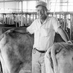
Carlton Melear

Carlton Melear

Winchesters and many others raised dairy cattle across the prairies that once were found in Boynton. During the time period of the 1930s to the 1960s, Boynton supplied almost all the milk for Palm Beach County, processed through the McArthur, Boutwell and Alfar Dairies. Low prices and increasing costs forced the farmers out of business, so they sold their lands to developers.
The citrus industry also was abundant in Boynton, with groves along Lawrence Road and to the west. Ridgeway Groves, Sun-Up Groves, Knollwood Groves and Palm Beach Groves had popular farm stands and citrus packing houses. These have all disappeared due to development.

Boynton High School: Past & Present

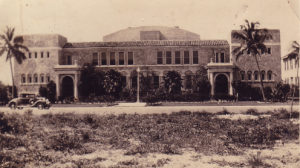
The Boynton High School was constructed in 1926-27 to meet the needs of the growing community. The brand-new building was seriously damaged in the 1928 hurricane, but repaired and brought quickly back into service.

The 30,000 square foot building is presently being remodeled. It is scheduled to open in June, 2019 as the Boynton Community Center.

Boynton Beach High School - 1932

Boynton High School – 1932

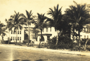
The Boynton Schools - 1935

The Boynton Schools – 1935

Boynton Beach History

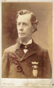
The city of Boynton Beach bears the name of Major Nathan Smith Boynton who came to South Florida from Port Huron, Michigan in 1895. The Civil War veteran and newspaper owner purchased oceanfront land and began construction of the Boynton Hotel  with workman recruited from Michigan.

Major Nathan S. Boynton

Major Nathan S. Boynton

They brought their families and settled in the new town.
When Henry M. Flagler brought the Florida East Coast railroad into Florida, visitors

seeking the warm weather of the area began arriving for  what was to become the winter tourist season. Even Boynton and his family, who spent their summers in Port Huron, came back to their Boynton Hotel for the winter.
Meanwhile, the area expanded rapidly as a farming community, growing vegetables for the hotel guests and opening up new sources of revenue through shipment of winter vegetables to other areas of the country.
Click here for a more complete history of the town’s founding.

Explore history by hovering on the history link above for specific subjects such as agriculture and the Boynton Hotel.


Publications Related to Boynton History:

  • Boynton Beach: The First 100 Years, Boynton Beach Historical Society, 1995
  • The History of Ocean Ridge, Gail Adams Aaskov, 1995, 2000
  • Images of America: Boynton Beach, M. Randall Gill in Conjunction with the Boynton Beach City Library, 2005
  • Postcard History Series: Around Boynton Beach, Janet DeVries, 2006
  • Images of America: Sport Fishing in Palm Beach County, Janet DeVries in Conjunction with the Boynton Beach City Library, 2008
  • Pioneering Palm Beach: The Deweys and the South Florida Frontier – Ginger L. Pedersen and Janet M. DeVries, 2012
  • The American Jungle: The Adventures of Charlie Pierce – Harvey Oyer III, 2008
  • The Last Egret: The Adventures of Charlie Pierce – Harvey Oyer III, 2010
  • The Last Calusa: The Adventures of Charlie Pierce – Harvey Oyer III, 2012
  • Pioneering Palm Beach: The Deweys and the South Florida Frontier – Ginger L. Pedersen & Janet DeVries, 2012

Boynton and Palm Beach County Land Research

Here is a collection of tools to help you do land record research in Palm Beach County.

1. Step 1 – Property Appraiser Web sitehttp://www.pbcgov.com/papa/index.htm

This website is very useful as a first step in land research. By typing in the current address, you can get the current owner’s name. From there, it is a backward search. Once you have the detailed information page on the property, you can hot link over to the Palm Beach County Clerk of Courts website to see the sales record that is attached in the detail on the PAPA website. This will give you key information such as the 1880s_Railroad_Surveyors2Section/Township/Range and the legal description of the property, which often has the plat book and page, which you can access in most cases.

2. Step 2 – Plat Books Web Sitehttp://www.pbcgov.com/pzb/pzbmaps/plats/platindex.htm

This website has most (but not all) Palm Beach County plats. Many of the very old books from the 1910s through the 1950s are not complete. This can be interesting to see how land was parceled out into smaller lots or tracts that the owners sold.

To see all the maps, please click here to display the instructions for accessing the Official Records Website.

3. Step 3 – Clerk of the County Court Official Records Web Sitehttp://www.mypalmbeachclerk.com/officialrecords.aspx

This website has all transactions, liens, warranty deeds, easements, back to 1968. Once you have an owner from the PAPA system and the section/township/range, you can research back and see former owners of the property.

Anything before 1968 requires a trip to the 4th Floor of the Palm Beach County Courthouse in downtown West Palm Beach. You can research the registry books yourself, and staff can help you in gaining access to microfilmed records. They charge $1.00 per page for printing of the microfilmed records.

Other Resources:

Learn  how to read legal land descriptions such as “the SW 1/4 of the NW 1/2 of NE 1/4″ – not as hard as it seems!  – Click here

Wikipedia Article on Section, Township, Range – http://en.wikipedia.org/wiki/Public_Land_Survey_System

Section/Township/Range Map of Palm Beach County – Click here

Federal Land Grant Patent Records (Homestead Act of 1862) – Click here

University of Florida  – Ancient Google Maps! See your property from the air from long ago – typical years are 1940, 1953 and 1968 –  http://ufdcweb1.uflib.ufl.edu/ufdc/?a=flap  Type in the modern address and the approximate location is marked on the old photograph.

Land Boundary Information System – Really ancient Google Maps! This archive has the original plat maps and drawings from the 1800s. Has the maps and the original surveyor notes from their field notes. The images are high resolution TIF files. As before, you will need to know the township and range of the area you want to research. http://data.labins.org/2003/SurveyData/LandRecords/GLO/index.cfm

Historic Aerials – More great aerial photography also included images from 1979 through the modern day – http://www.historicaerials.com/Default.aspx – You can draw in modern day streets over the photos, or slide back and forth between today and then – very neat.

The South Lake Worth (Boynton) Inlet History

SOUTH LAKE WORTH INLET (BOYNTON INLET) 

The Boynton Inlet, or what is officially known as the South Lake Worth Inlet, was a project that took many years to happen. Originally, Lake Worth was a fresh water lake. When the Palm Beach Inlet was opened in the 1800s, it changed to a salt water lagoon. At the far end

The Boynton Inlet

The Boynton Inlet

of the lake, the water was more brackish. Several cities used the lake to dump raw sewage. It was felt that making an additional opening to the sea would help “flush” the lake and to provide access for anglers and sport fishing.

The inlet was opened in 1927, and is a popular recreational spot for picnics and fishing.

The original article from March 17, 1927, announcing the inlet opening, from the Palm Beach Post.

CONNECTING CUT IS MADE AFTER YEARS OF ENGINEERING WORK

Scores Watch Ceremonial Labor at 11 o’clock Wednesday Night

At 11:18 o’clock last night the South Lake Worth Inlet at Boynton became a reality.

For at this hour waters from the Atlantic ocean glided in through the tiny cut, shoveled in the sand, and mingled with the waters of Lake Worth, for the first time at this point, filling the channel cut by a huge clam shell dredge. Dozens of spectators leaned from the bridge, which tops the project, and watched the operations by the glare of large search lights, while others tramped through the sand below to stand on the point to observe the laborers as they shoveled the opening wedge through which the ocean flowed.

Although about two weeks work yet remains for dredging the sand and cutting through part of the rock in the channel, last night’s task marked the official opening of the South Lake Worth inlet and the real termination of the project extending over a period of many years.

The South Lake Worth inlet, connecting the Atlantic ocean and Lake Worth, at a point just north of Boynton and the head of the lake, when completed will be available for pleasure craft, as well as being a vehicle for drainage. A depth of five feet at low tide will be increased to seven at high tide with a space of 154 feet between the two front jetties, and a 32 foot overhead clearance under the bridge.

Conceived in 1923, the project was almost one year in assuming definitive shape at the end of which time plans had been drawn, estimates made, the inlet district created and the project financed. The district extends from Southern Boulevard in West Palm Beach to a point one mile south of Boynton.

Riddle Brothers, engineers, were engaged to have charge of the entire projects, and last night both Karl and Kenyon Riddle of the firm, stood on the sands and watched the culmination of the $225,000 project, together with many of the town officials.

The concrete bridge, which has no draw, was completed August 1, 1924. Work started on the inlet proper in September, 1923, first on the solid concrete jetties, both of which withstood both hurricanes last summer without damage. The jetties, according to the engineering are of a peculiar construction, unique along the coast.

A suction dredge has been at work on the channel for some time and on Tuesday of this week the clam shell dredge began operations in a 21 hour-a-day schedule. It is expected that with the opening wedge cut, much of the sand will wash out to sea during high tides.